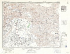
US AMS Series U502 PAKISTAN TOPO MAPS full color original 1:250,000
Specifications
| All Returns Accepted | ReturnsNotAccepted |
| Country/Region Of Manufacture | United States |
| Publication Name | Series U502 |
| Region | South Asia |
| Series | U502 |
| Format | paper map |
| Country | Pakistan |
| Type | Topographic Map |
| Features | Limited Edition |
| Map Scale | 1:250,000 |
| Author | US Army Map Service |
| Subject | Geography |
| Publication Year | 1963 |
| Language | English |
| Publisher | US Army Map Service |
| City | multiple |
For sale here are six US Army Map Service topo maps covering portions of Punjab, Sindh & Khyber Pukhtunkhwa in Pakistan. Each map is offered at $5.00 plus shipping, well-below current asking price for these vintage maps. YOU CHOOSE which map or maps you want. Please contact me through ebay before placing your order to confirm your order and price. The maps available are: NH 42-3 Fort Sandeman Pak-Af border (includes part of Afghanistan) NH 42-6 Loralai Mountains east of Quetta NH 42-7 Mekhtar Hill country east of Loralai NH 42-10 Sibi Indus River NG 42-1 Wandhari West of Indus River NG 42-15 Islamkot Rann of Kuch - India border Please see the picture of the U502 series Map Index to locate the map sheets on offer (the map number is circled in yellow) and contact me through ebay to let me know your selection. Please note that you will receive a 5% discount for each additional map you purchase (up to a total of 20% discount). Additionally, shipping costs will be lower for multiple map purchases. Maps will be shipped in a sealed 24” x 2” x 2" mailing tube, USPS Media Mail. The US Army Map Service (AMS) Series U502 India and Pakistan was published between the late 1950s and early 1960s, and was last revised in 1962. The US AMS was subsequently superseded by the Defense Mapping Agency and the AMS U502 series was declassified in the 1970s. The U502 series remains highly accurate for topographic details. Each map has a "reliability diagram" that shows its degree of accuracy. The maps show most villages and canal systems, but not recently-built roads, in typically greater detail than freely available "Earth" imaging on the internet. These "like-new"original four-color maps have 500-foot contour intervals and are at a scale of 1:250,000. Each map covers one degree of latitude and 1½ degrees of longitude. The graphic detail of each map measures 18 inches high by 24 inches wide (excluding the map border, legend, reliability diagram, etc.), with the entire map sheet measuring approximately 24 inches high by 30 inches wide. Please see the image of the Sibi map (pic) as an example of how the maps appear and condition. Thanks for looking! Please see my other listing for U502 maps of India.
Related Items