
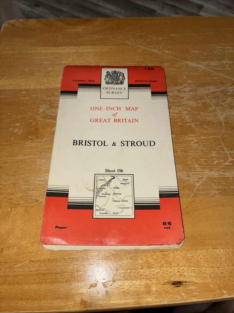
1953 Ordnance Survey One Inch Seventh Series Map 156 Bristol And Stroud
USD 4.79 USD
Specifications
| Series | Ordnance Survey |
| Type | Map |
| Publication Name | Ordnance Survey |
| Author | Ordnance Survey |
| Item Weight | 75g |
| Country Of Origin | United Kingdom |
The 1953 Ordnance Survey One Inch Seventh Series Map 156 features detailed mapping of Bristol and Stroud, produced by the Ordnance Survey. This vintage map, weighing 75g, is a valuable resource for historical research, navigation, or simply as a decorative piece for those interested in cartography. With its authentic design and authoritative content, this map provides a glimpse into the past and is a unique addition to any collection of maps and atlases.
Related Items

Woodbridge and Saxmundham: Sheet 212 (Ex… by Ordnance Survey Sheet map, folded
Penarth Docks or Penarth Town 1915 Glamorgan Sheets 47.07 & 47.11

America Discovered : A Historical Atlas of North American Explora
Admiralty Small Craft Chart 5614_7: Cromer to Wells-next-the-Sea

Vintage Harrogate Small Street Map.

Ordnance Survey Road Atlas of Great Britain 1983

National Geographic Collegiate Atlas of the World, Second Edition by Geographic

OS Ordnance Survey 1″ New Popular Edition sheet 190 Truro & Falmouth; 1946 paper