


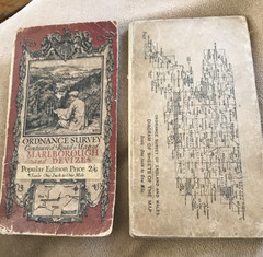


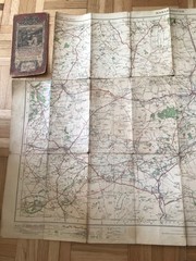
MARLBOROUGH- 1929 OS Popular Edition 1” Contoured Road Map
USD 9.35 USD
Specifications
| Publication Name | Ordnance Survey / Other |
| Publisher | Ordnance Survey |
| City | Oxford |
| Series | Ordnance Survey |
| Publication Year | 1929 |
| Type | Map |
| Format | Folding Map |
| Language | English |
| Author | Ordnance Survey / Other |
| Region | Great Britain |
| Country | United Kingdom, England |
| Country Of Origin | United Kingdom |
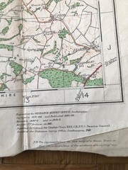
The MARLBOROUGH 1929 OS Popular Edition 1” Contoured Road Map is a vintage Ordnance Survey map that provides detailed information on the geography and geosciences of Oxford and the surrounding region. This folding map, published by Ordnance Survey in 1929, features a contoured road map design that allows users to easily navigate the roads and streets of Great Britain. Written in English and originating from the United Kingdom, this map is a valuable resource for those interested in exploring the history and culture of England, United Kingdom.
Related Items

Planet Earth Macmillan World Atlas …, Prebenna, David

Where To Go When (DK Eyewitness Travel Guide) – Hardcover – VERY GOOD

OS, 6 Inch to 1 Mile Map, sheet ST 22 NE,Somerset, Creech St Michael area, 1969

Admiralty Small Craft Chart 5602_15: Plymouth Sound, Northeastern Part

Collins Maps Collins Ireland Film and TV Location Map (Map)

Glen Carron and West Monar by Ordnance Survey (Sheet map, folded)

Guide to Australian Heritage Trains… by McKillop Robert F Paperback / softback

Connel (Map) 1: 50 000 Series Geological Maps (Scotland) (UK IMPORT)