
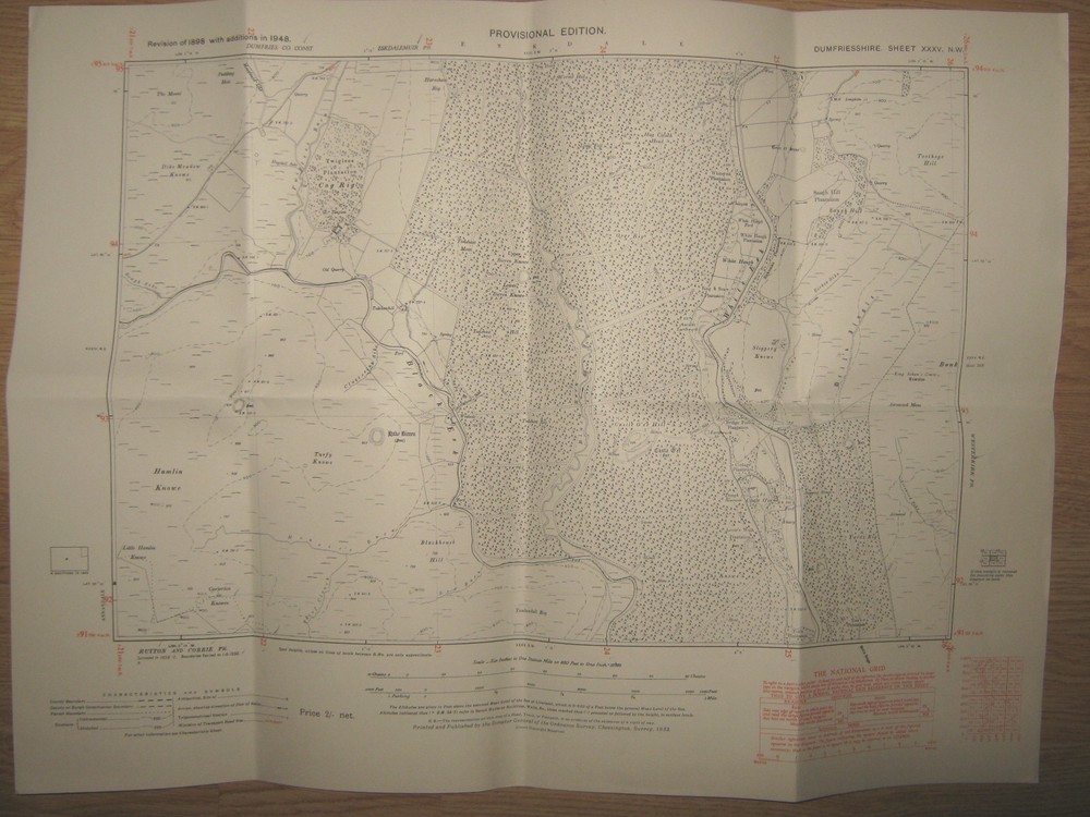
Ordnance Survey 6 inch -1 mile map Dumfriesshire Sheet XXXV NW, Castle O’er Hill
USD 22.85 USD
Specifications
| Date Of Publication | 1951 |
| Publication Name | ordnance survey |
| Publisher | Ordnance Survey |
| City | Castle O'er Hill |
| Series | Ordnance Survey |
| Publication Year | 1951 |
| Type | Historic map |
| Format | Sheet map |
| Language | English |
| Region | UK, Great Britain |
| Country | Scotland |
| Author | Ordnance Survey |
| Map Scale | 1:10560 |
| Country Of Origin | United Kingdom |
Provisional Edition. Original flat map. Covering an area on the ground 3 miles east to west and 2 miles north to south, contours shown in red. Revision of 1898 with additions in 1948 (Published 1951).
Related Items

Vintage Bartholomew’s Half Inch Cloth Map, No 35, Teesdale, 1947

OS Ordnance Survey Landranger Map Sheet 183 Yeovil & Frome – 1999
The Ordnance Survey Atlas of Great Britain, 1982 1st Edition HB

The English Lakes: South Western Area (O… by Ordnance Survey Sheet map, folded

Cardigan and Mynydd Preseli (Landranger … by Ordnance Survey Sheet map, folded
Ordnance survey tourist maps EXMOOR x 2

THE CIA WORLD FACTBOOK 2016 By Central Intelligence Agency *Excellent Condition*
Philip’s Navigator Road Map East Sussex by Philip’s Maps Hardback Book The Fast