


Vintage Ordnance Survey Land’s End Sheet 189 Map 1946 With Writing
USD 20.05 USD
Specifications
| Publication Year | 1946 |
| Publication Name | One Inch Map Land’s End |
| Publisher | Ordnance Survey |
| City | Land’s End |
| Series | Ordnance Survey |
| Type | Hiking Map |
| Format | Cloth Book |
| Language | English |
| Author | Ordnance |
| Country | England, United Kingdom |
| Region | South West England |
| Features | Folding Map |
| Country Of Origin | United Kingdom |
Original vintage Ordnance Survey New Popular Edition One Inch Map of England and Wales, Sheet 189 covering Land’s End and the surrounding Cornwall area. First published in 1946 with a 1931 full revision and later corrections. A genuine vintage map featuring original owner writing/annotations to the reverse cover, adding to its period character. Condition is used with age related wear, creasing, edge wear and marks to the cover as shown in the photographs. A great item for collectors of vintage maps, Cornish history, memorabilia or decorative display.
Related Items

AA Travel European Throughroute Map of Oostende & Zeebrugge
Admiralty Small Craft Chart 5600_21: Cowes Harbour
Edinburgh Streetfinder Street Atlas, Bartholomew with Street Atlas

Collins Mini Atlas of the World by Collins: Used
PEMBROKE Bartholomew Revised Contoured Half Inch Map Sheet 11 Paper 1961

Bradford and Huddersfield (Map) OS Explorer Map
Ashton in Makerfield 1906 or Ashton in Makerfield (E) 1907 Lancs 101.07/101.08
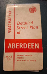
Geographia Vintage 1960s Aberdeen Street Plan