


Philip’s Navigator Street Atlas Bristol & Bath by Philip’s Maps (Spiral bound)
USD 18.13 USD
Specifications
| Author | Philip's Maps |
| Publication Year | 2022 |
| Format | Spiral bound |
| Language | eng |
| Country Of Origin | China |
| Item Height | 1.5 cm |
| Item Length | 19.3 cm |
| Item Weight | 416 g |
| Item Width | 27.0 cm |
| Publication Name | Not Available |
| Type | Not Available |
| ISBN | 9781849076012 |
The only street atlas of its kind, this fully updated mapping of Bristol and Bath gives comprehensive and detailed coverage of the county and unitary authority - perfect for finding the best and most effective route anywhere in the area. Routinely used by the emergency services, the street maps show every named road, street and lane very clearly, with major roads picked out in colour. The route planner shows all the A and B roads, and can be used when driving to get close to the destination before turning to the relevant large-scale street map. The maps are at a standard scale of 3.5 inches to 1 mile, and show postcode boundaries.
Related Items

Lonely Planet South Australia Planning Map (Sheet Map, Folded)
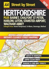
AA Street by Street Hertfordshire by AA Publishing Spiral bound Book The Fast

Lonely Planet Japanese Phrasebook & Dictionary by Lonely Planet (Paperback Book)

Greece – Michelin National Map 737 Map by Michelin (Sheet map, folded)

OS Map Kids Apron – North York Moors National Park (General merchandise)

Cyprus, Automap 1:150.000, Top 10 Tips by Freytag-Berndt (Sheet map, folded)

Lake District & Cumbria Cycle Map 22 (Map) Cycle Maps UK

Chart Kit BBA Florida West Coast & The Keys Region 8 89 Full Color Charts B221