


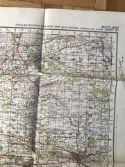

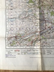
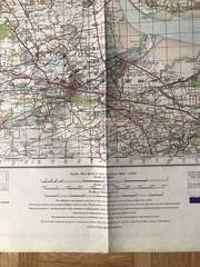
1945 Military System Map- Stirling & Dunfermline War Office Edition
USD 19.81 USD
Specifications
| Publisher | Ordnance Survey |
| City | Scotland |
| Subject | Wars |
| Publication Year | 1945 |
| Series | Ordnance Survey |
| Type | folding sheet map |
| Unit Type | Unit |
| Format | Paper |
| Language | English |
| Country | United Kingdom |
| Region | Great Britain |
| Country Of Origin | United Kingdom |
The 1945 Military System Map of Stirling & Dunfermline by Ordnance Survey is a historical folding sheet map featuring a detail of the region. Published in 1945 as part of the Ordnance Survey series, this map is a valuable resource for those interested in the wars of the time. Produced in the United Kingdom by the Director General's Office, this paper map in English language provides a unique insight into the military operations of Great Britain during World War II.
Related Items

Liverpool and The Wirral 1904: One Inch S… by Pratt, Derrick Sheet map, folded
👀 National Geographic’s, Peoples of the Soviet Union 👀

Port of Neum | NGA Chart 54230

Park & Ride The Gateway to Oxford – Street Map & Bus Timetable
Vintage Hammond Concise Atlas of the World Leather Classics Princess Cruises NEW

Lonely Planet The World: A Traveller’s Guide to the Planet | Every Country from
historical atlas of the world

The Historical Atlas of Judaism by Barnes & Bacon HC Map Photos