


8 x National Grid 7th Series Ordnance Survey One-Inch Map Variety of Locations
USD 41.76 USD
Specifications
| Return Postage Will Be Paid By | Buyer |
| Returns Accepted | Returns Accepted |
| After Receiving The Item, Your Buyer Should Cancel The Purchase Within | 14 days |
| Publication Year | 1950s And 1960s |
| Type | Road Map |
| Format | Folding Map |
| Language | English |
| Publication Name | National grid |
| Author | Ordnance Survey |
| UK Region | Other UK Maps |
| Country/Region Of Manufacture | United Kingdom |
8 x National Grid 7th Series Ordnance Survey One-Inch Map Variety of Locations. Some mounted on cloth, some paper. Mix of 1950s and 1960s. Locations as follows: Fakenham (125) Shrewsbury (118) Stoke on Trent (110) Stafford (119) Chester (109) Pwllheli (115) Burton on Trent (120, paper) Burton on Trent (120, mounted on cloth)
Related Items

Ordnance Survey (OS) 1:25,000 First Series Map Sheet SN 24 Llechryd

A Feckin’ Tour of Ireland: 50 Must Do Things

Admiralty Charts SC 5603 – Falmouth to Hartland Point 7th Edition

Ordnance Survey Landranger 1:50,000 sheet 101 Scarborough – 1976
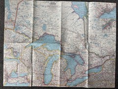
National Geographic Magazine Paper Map Of Central Canada 1963 Atlas Plate 24

This Is A Book On, Utahs National Parks Which Will Give You Knowledge About It.

Hammond Atlas of the 20th Century, Hammond Incorporated

How To Paint Watercolors That Shin- William C Wright, 1929834470, paperback, new