

Admiralty Small Craft Chart 5600_7: Yarmouth to Beaulieu River
USD 22.87 USD
Specifications
| Country Of Origin | United Kingdom |
| Brand | Admiralty |
| Language | English |
| Publisher | Admiralty |
| Sub-Type | Small Craft Chart |
| Subject Area | Nautical |
| Type | Nautical Chart |
The Admiralty Small Craft Chart 5600_7 covers the area from Yarmouth to Beaulieu River, providing detailed navigational information for small craft. Produced by the United Kingdom Hydrographic Office and printed to order on 535 x 715 mm chart paper, this nautical chart is essential for mariners and boat owners in the United Kingdom and Ireland. With its clear and accurate information, this chart helps ensure safe and efficient navigation along the coast from Yarmouth to Beaulieu River.
Related Items

1966 OS Ordnance Survey One Inch Map – ABERYSTWYTH – Sheet 127

Jigsaw Atlas of Dinosaurs (Jigsaws) by Glen Bird Board book Book The Fast Free

1978 Vintage Box Maps Book 1-15 National Geographic Society Close-Up: USA

Freytag-Berndt Gomera, Walking map 1:35.000 (Map) (UK IMPORT)

Large Selection Of Original 1887 George Phillip & Son Maps – Various countries
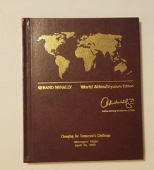
Rand McNally World Atlas, Signature Edition Andrew Mcnally. April 13, 1995.

Central Northants 1906 One Inch Sheet 185 by Barrie Trinder

Greater London (AA Street by Street) by AA Publishing Paperback / softback Book