
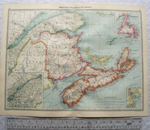
c1907 Harmsworth Plate No. 159-160 Maritime Provinces of Canada & Newfoundland
USD 5.38 USD
Specifications
| Publication Year | 1907 |
| Type | Atlas |
| Format | Wall Map |
| Language | English |
| Region | North America |
| Author | Unknown |
| Country | Canada |
| Publisher | Harmsworth |
| Country/Region Of Manufacture | United Kingdom |
A map by George Philip & Son, The London Geographical Institute which has been removed from The Harmsworth Atlas and Gazetteer of the World (c1907). Size: 52 x 40 cm approx. This item will be despatched in a strong postal tube. I can combine P&P providing you wait for an invoice before making payment. Log into ebay.co.uk and place the items in your basket, then use the “Request Total from Seller” (do not use the Proceed to Checkout button). I will then weigh your items and send you an invoice. If you are using a mobile app, this facility is sometimes not available and you may need to log in on a desktop or laptop.
Related Items
Lot of 3 Road Atlases, 1972 & 1994, Hardback & Paperback

MAP OF Warlingham 1910: Surrey Sheet 20.11 by Richard Oliver NEW

Great Fighting Planes Alan Austin Anthony Dicks 1985

1973 old vintage OS Ordnance Survey Map 1:50000 First Series 135 Aberystwyth

Ordnance Survey (OS) 1:10 000 Original Sheet Map, WARWICKSHIRE SP 47 SW, 1990

OS Ordnance Survey Landranger Map Sheet 127 Stafford & Telford – 2004

Harvey Map Services Ltd. Cycling Map of Highland Perthshire (Map) (UK IMPORT)

Deptford (High Street) 1868-94 London Large Scale Sheet 11.30 by Pamela Taylor