

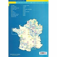
Editions Du Breil 06: La Charente Waterway Guide book France inland waterways
Specifications
| Return Postage Will Be Paid By | Buyer |
| Returns Accepted | Returns Accepted |
| After Receiving The Item, Your Buyer Should Cancel The Purchase Within | 30 days |
| Author | Editions Du Breil |
| Publication Name | La Charente |
| Type | Atlas |
| Publisher | Editions Du Breil |
| Country | France |
| Publication Year | 2013 |
| Region | France |
| Format | Paperback |
| Country/Region Of Manufacture | France |
| Item Height | 4mm |
| Item Length | 297mm |
| Item Weight | 0.278kg |
| Item Width | 210mm |
| MPN | Does not apply |
eBay Store Design by Visualsoft Editions Du Breil 06: La Charente Waterway Guide book France inland waterways £22.000 | The Editions Du Breil 06: Charante Waterway Guide covers the Charente between Angoulême and the sea and the river Boutonne. Ask a Question Description The Charente is a coastal river 361 km long, navigable between Angoulême and the sea. It can be divided into two sections: the canalised part between Angoulême and Saint-Savinien and the free flowing section between Saint-Savinien and the sea. Inland waterways craft can go as far downstream as Rochefort. With the exception of the lock at Saint-Savinien, all the locks are self operated. The river is rarely closed to navigation, even during the driest periods but the available draft upstream from Jarnac can be limited in mid-summer. In the latest edition of this guide the publisher has concentrated on the estuary, updating information on the seaside town of Fouras and the historic maritime city of the Rochefort. They also added is a map of the River Boutonne which used to be navigable as far as Saint-Jean d'Angely. eBay Store Design by Visualsoft
Related Items


