

Harlech, Porthmadog Bala Map Ol 18 Ordnance Survey G In Sleeve
USD 13.43 USD
Specifications
| Series | Ordnance Survey |
| Region | Great Britain |
| Country/Region Of Manufacture | United Kingdom |
| ISBN | 9780319240106 |
The Harlech, Porthmadog Bala Map OL 18 Ordnance Survey G is a detailed travel map published in 2008 by Ordnance Survey. This sheet map, measuring 240 mm in height, provides a scale of 1:25,000 and covers the area around Harlech, Porthmadog, and Bala in the United Kingdom. With a focus on transportation and sports, this English language map is a valuable resource for those looking to navigate the region with ease and accuracy.
Related Items

Ordnance Survey (OS) 1:10 000 Original Sheet Map, WARWICKSHIRE SP 15 SE, 1993

BARTHOLOMEW Half Inch Cloth Maps x4 1940s Castle Douglas – Anglesey – SW London

ORDNANCE SURVEY ONE INCH MAP: OXFORD & NEWBURY

Collins Superscale Atlas Britain 91/92 edition

Bartholomew’s Readers Digest Touring Map SCOTLAND 1994

OS, 6 Inch to 1 Mile Map, sheet ST 35 NE, Somerset, Loxton area, 1962
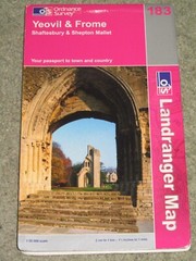
OS Ordnance Survey Landranger Map Sheet 183 Yeovil & Frome – 2005

Vintage LONDON CC Municipal Map 1930 – HAMPSTEAD HEATH, HIGHGATE, TUFNELL PARK