
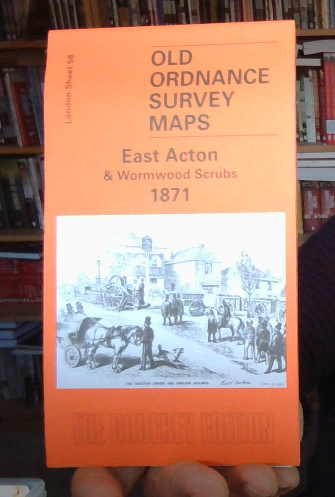
MAP OF East Acton and Wormwood Scrubs 1871 London Sheet 058.1 by John Griffiths
USD 4.64 USD
Specifications
| Type | Street Map/Directory |
| Author | John Griffiths |
| ISBN | 9781841517506 |
We have published three versions of this map, showing how the area developed across the years. The 1871 map shows a rural area, with the village of East Acton surrounded by fields; features include the Manor House, The Grange, Goldsmiths Almshouses, Acton station, Old Oak Common Lane, Friars Place, Friarsplace Farm, Wormholt Farm, Old Oak Farm.
Related Items
Ashton in Makerfield 1906 or Ashton in Makerfield (E) 1907 Lancs 101.07/101.08

Weekend Escapes by Gregory’s See Australia Bruce Elder & Denise Imwold – PB

MAP OF New Hartley & Delaval Hall 1920 Northumberland Sheet 78.15 NEW

MAP OF Manchester (Victoria Park & Longsight) 1916 Lancashire Sheet 104.15 NEW
MAP OF Coalbrookdale & Lightmooor 1925 Shropshire Sheet 43.10 NEW 9781787217904
MAP OF Ketley 1901: Shropshire Sheet 36.14 by Barrie Trinder NEW 9780850544008

Lower Irlam & Cadishead 1926 Lancashire Sheet 110.05 by Chris E Makepeace NEW

Ripley or Butterley & North Ripley 1898 Derbyshire Sheet 40.07 or 40.11