

MAP OF Mirfield & Ravensthorpe 1905: Yorkshire Sheet 247.06 Godfrey, Alan NEW
USD 4.95 USD
Specifications
| Binding | Sheet map, folded |
| Artist | Godfrey, Alan |
| Date Of Publication | 2008-03-26 |
| Publisher | Alan Godfrey Maps |
| Type | Street Map/Directory |
| EAN | 9781847841148 |
| Format | books |
| ISBN | 1847841147 |
| Language | English |
| Author | Godfrey, Alan |
| Country Of Origin | United Kingdom |
This detailed map covers the central and eastern part of Mirfield, plus much of Ravensthorpe. Coverage extends from Mirfield station eastward to St Saviour's church Ravensthorpe, and from St Mary's church Mirfield southward to Hopton Bottom.
Related Items

Blackpool and Preston (Map) OS Explorer Active Map (UK IMPORT)

Philip’s 5-Star Navigator Britain: Spiral by Philip’s Maps Spiral bound Book The
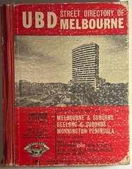
*LOT* **VHTF** UBD STREET DIRECTORY OF MELBOURNE 1967 AND 1968 **x 2 included**

Philip’s Atlas Of The World 2013 (Hardback) RRP £75.00 Book The Fast Free

Fifty SCOTLAND ORDNANCE SURVEY MAPS 1:50 000 1956-1986 Many ex-library

New Concise World Atlas by Oxford University Press

Geological survey map Wells Ordinance Survey Solid & Drift Sheet 280 1963

Germany Insight Travel Map Sheet map, folded Book The Fast Free Shipping