



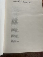



Mill’s Atlas: Atlas of the State of South Carolina 1825
USD 750.00 USD
Specifications
| All Returns Accepted | ReturnsNotAccepted |
| Item Length | 8 1/2 in |
| Publication Year | 1980 |
| Series | Historical |
| Format | Hardcover |
| Language | English |
| Item Height | 11 in |
| Author | Robert Mills |
| Region | North America |
| Country | United States |
| Map Scale | 2 miles per inch |
| Features | Ex-Library |
| Country/Region Of Manufacture | United States |
| Item Weight | 3 lbs. |
| Item Width | 1 in |
Explore the first atlas of an American state with Mill's Atlas: Atlas of the State of South Carolina 1825. This historical hardcover book, published by Southern Historical Press in 1980, features 43 pages of detailed maps, including fold-outs, with a scale of 2 miles per inch. Authored by Robert Mills, this English language publication measures 8 1/2 inches in length, 11 inches in height, and 1 inch in width, weighing 3 lbs. I found one other that was in not as good shape with highlighting in it. It was listed for 899.00
Related Items

Philip’s Street Atlas West Sussex: Pocket by Philip’s Maps Paperback / softback

Bartholomew Half Inch Cloth Map 5 New Forest 1964 Folding Cloth Map

Admiralty Small Craft Chart 5600_8: River Hamble

Lonely Planet Munich City Map Durable, Waterproof, EasyFold Planning Map with…

2011 COLLINS EUROPE ESSENTIAL ROAD ATLAS: NEW A4 EDITION By Collins Uk

New Jerseys Special Places: Scenic, Historic and Cultural Treasures in t – GOOD

The Penguin State of the World Atlas: – Paperback, by Smith Dan – Acceptable n

France 2000 (Michelin Maps) by Michelin Travel Publications Sheet map, folded