
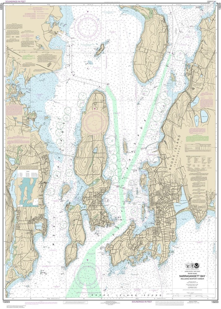
Narragansett Bay, Including Newport Harbor | Waterproof NOAA Chart 13223
USD 20.57 USD
Specifications
| Return Shipping Will Be Paid By | Buyer |
| Returns Accepted | Returns Accepted |
| Item Must Be Returned Within | 30 Days |
| Author | TrakMaps |
| Publication Name | TrakMaps |
| Type | Geological Map |
| Publisher | TrakMaps |
| Region | North America |
| Country | United States |
| Format | Wall Map |
| Language | English |
| Subject | Geography & Geosciences |
| Map Scale | 1:20000 |
| Country/Region Of Manufacture | Canada |
| MPN | 5206 |
Official waterproof NOAA chart printed on demand. Printed on waterproof and tear-resistant synthetic paper. Perfect for fishing and boating.
Related Items

Ordinance Survey 2007 Outdoor Leisure OL 22 New Forest Explorer Map
Hammond Discovery World Atlas Hammond Incorporated paperback Used – Good

An Atlas of Tolkien (Tolkien Illustrated Guides) by David Day
Admiralty Instructional Chart 5137: St Ann’s Head to Newton Noyes Pier

AA Big Easy Read France (AA Atlases and Maps) by AA Publishing Spiral bound The

BE EXPERT WITH MAP AND COMPASS: THE COMPLETE ORIENTEERING By Bjorn Kjellstrom

NATIONAL GEOGRAPHIC 100 Drives 5000 Ideas Travel Guide Softcover Book 2017

Mappings: Society/Theory/Space Ser.: Power of Maps by Denis Wood (1992, Trade…