
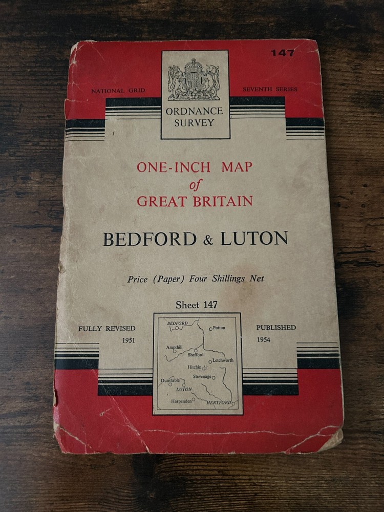
One Inch Ordnance Survey Map Sheet 147 BEDFORD & LUTON 1954 – Paper Vintage
USD 3.36 USD
Specifications
| Series | Ordnance Survey |
| Publication Year | 1954 |
| Type | Ordnance Survey |
| Publication Name | Ordnance Survey Map |
| Country | United Kingdom |
| Region | Great Britain |
| Author | Ordnance Survey |
| Publisher | Ordnance Survey |
| Country Of Origin | United Kingdom |
The product is a vintage Ordnance Survey map sheet from 1954 covering the BEDFORD & LUTON area. Published by the Ordnance Survey in the United Kingdom, this map is a valuable historical resource for those interested in Great Britain's geography. Perfect for collectors, historians, or anyone looking to explore the region in detail, this one-inch map provides a fascinating insight into the area's topography and features from over six decades ago.
Related Items

Ordnance Survey – One Inch Map – Truro and Falmouth – Sheet 190 – 1961

OS Ordnance Survey Landranger Maps – Wales – assorted editions 1974-1997 – ‘vgc’
Old Ordnance Survey Maps Old Trafford 1905

Vintage Ordnance Survey & Bartholomew’s One &Half Inch Maps Exmoor Weston
Wick Map – Ordnance Survey Sheet 16 – 1959
Doncaster Wakefield Ordnance Survey Sheet 22 First Edition Reprint 1980 1st

OS Ordnance Survey Landranger Map Sheet 156 Saxmundham & Aldeburgh area – 1994

Northern England: Ordnance Survey Road Map Sheet 4 (2016) Regional Coverage NEW