

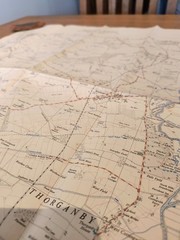
Ordinance Survey map SE64 Yorkshire Provisional Edition 1954
USD 13.33 USD
Specifications
| Publication Year | 1954 |
| Series | Ordnance Survey |
| Type | Sheet map |
| Language | English |
| Publication Name | SE64 |
| Country | United Kingdom |
| Region | Great Britain |
| Author | Ordinance Survey |
| Publisher | Ordnance Survey |
| Country Of Origin | United Kingdom |
The OS map sheet number SE64 is a provisional edition Ordnance Survey map from 1954, depicting Yorkshire county in the United Kingdom. This map features Elvington, Thorganby and Escrick. Produced by Ordinance Survey, this sheet map is a detailed representation of the area, making it a unique and sought-after collectible for map enthusiasts and historians alike. The map has been folded so has some creases and signs of wear around the edge (see photos). It is in good condition for its age. I have several similar maps available so check out my other listings and save on postage. Thanks!
Related Items

Lanark and Upper Nithsdale (Landranger M… by Ordnance Survey Sheet map, folded

Ordnance Survey Map Perth and Alloa Vintage ra
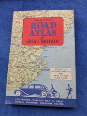
Road Atlas of Great Britain 1955 Hardback Book Vintage VGC – USED with DJ
The Routledge Companion to Strabo by Daniela Dueck (English) Paperback Book

Freytag-Berndt Stockholm City Map 1:15,000 (Map) (UK IMPORT)
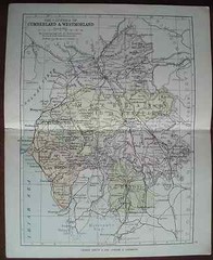
Antique colour map Cumberland Westmorland late Victorian George Philip Railways
Bath A-Z by Ordnance Survey Paperback / softback Book The Fast Free Shipping
National Geographic Collegiate Atlas of the World by National Geographic (2006,