
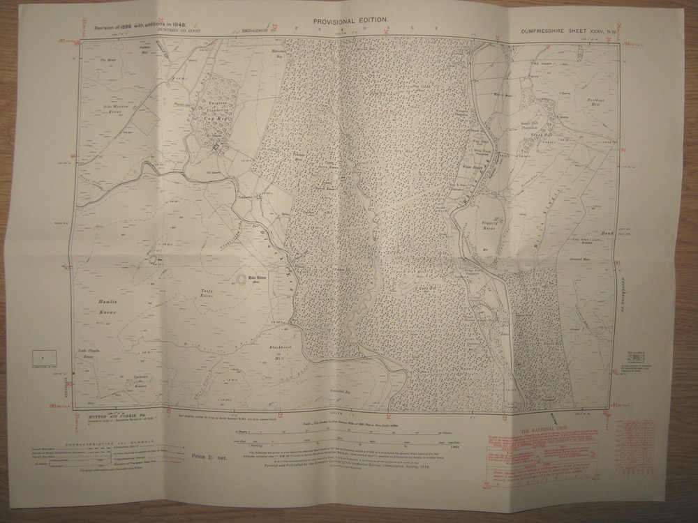
Ordnance Survey 6 inch -1 mile map Dumfriesshire Sheet XXXV NW, Castle O’er Hill
USD 22.85 USD
Specifications
| Date Of Publication | 1951 |
| Publication Name | ordnance survey |
| Publisher | Ordnance Survey |
| City | Castle O'er Hill |
| Series | Ordnance Survey |
| Publication Year | 1951 |
| Type | Historic map |
| Format | Sheet map |
| Language | English |
| Region | UK, Great Britain |
| Country | Scotland |
| Author | Ordnance Survey |
| Map Scale | 1:10560 |
| Country Of Origin | United Kingdom |
Provisional Edition. Original flat map. Covering an area on the ground 3 miles east to west and 2 miles north to south, contours shown in red. Revision of 1898 with additions in 1948 (Published 1951).
Related Items

Harvey Map Services Ltd. Dartmoor for Cyclists (Map) (UK IMPORT)

Annapolis Harbor | Waterproof NOAA Chart 12283

UK ORDNANCE SURVEY Pathfinder (1:25000) Map 424 – Portnahaven & Port Charlotte

Haven Europe : Map of Europe

Where To Go When: Travel Adventures for Every Month by DK Eyewitness (English) H

Flintshire Towns (Local Red Book S.) Paperback / softback Book The Fast Free

Freytag-Berndt European-Middle East-Central Asia political (Map)
Ordnance Survey – OS 1:25,000 First Series Map Sheet SU 74 Froyle