
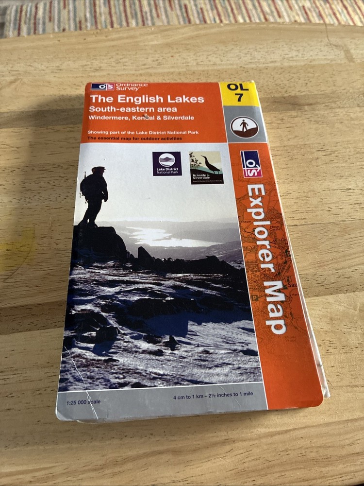
Ordnance Survey Explorer Map OL 7 The English Lakes South Eastern Area
USD 6.05 USD
Specifications
| Publication Name | Explorer |
| Publisher | Ordnance Survey |
| Subject | Transportation, Sports |
| Series | Ordnance Survey |
| Publication Year | 2002 |
| Type | Travel Maps |
| Format | Sheet Map |
| Language | English |
| Country | United Kingdom |
| Region | Great Britain |
| Author | Ordnance Survey |
| Features | Folding Map |
| Map Scale | 1:25,000 |
| Country Of Origin | United Kingdom |
The Ordnance Survey Explorer Map OL 7 covers the South Eastern Area of the English Lakes, providing detailed information for travellers and outdoor enthusiasts. Published by Ordnance Survey in 2002, this sheet map features a map scale of 1:25,000 and includes features such as a folding map for ease of use. With a focus on transportation and sports, this map is a valuable resource for exploring the picturesque region of Great Britain.
Related Items

Periplus Editors Yogyakarta Travel Map Fourth Edition (Map)

Local Red Book GUILDFORD WOKING Street Maps 10th Revision PB Book VGC

1991 Ordnance Survey Pathfinder Map 1316 SY 29/39 Lyme Regis And Axminster

Reader’s Digest Atlas Of The World – 1989 Hardcover Book – Very Good Condition

Travel Writing 2.0 (Third Edition): Earning money from your travels in the ne…
Geological Survey of Great Britain: Coventry 169 (part sheet)
Dorset Coast and Country by Car (White Horse) Paperback Book The Fast Free

National Geographic Satellite Atlas of the World (Direct Mail Edition): Used