

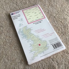

Ordnance Survey Landranger map 140: Leicester, Coventry & Rugby MINT
USD 6.69 USD
Specifications
| Country/Region Of Manufacture | United Kingdom |
| ISBN | 9780319222553 |
Here is an Ordnance Survey Landrange Map, scale 1:50,000. It is OS map 140 Leicester, Coventry & Rugby. It has been never been used and is in mint condition. From OS: "For when it’s about the journey, not the destination. . . Our pink Landranger maps cover long distances making them perfect for an extensive hike, cycling tour, or driving holiday. It’s the perfect companion for your next trek or excursion – providing information on footpaths, rights of way, & plenty of tourist information". BUY WITH CONFIDENCE, CHECK MY FEEDBACK!
Related Items

245 259 THE NATIONAL FOREST, DERBY, LOT EXPLORER ORDNANCE SURVEY MAPS OS

(G116) Map of Twickenham TW Postcode Sectors, Poster of Twickenham Postcodes

Ordnance Survey Map 1:50,000 Sheet 25 Glen Carron

5 West of England WEST COUNTRY OS Landranger Maps 1:500

Ordnance Survey One-Inch Map, Sheet 150: Ipswich (1969).

Barnehurst 1897 Kent Sheet 3.13 by E Thomas
Swindon (SW) 1899 or 1922 Wiltshire Sheet 15.07

North Greenford 1938 Middlesex Sheet 15.03 by Frances Hounsell