


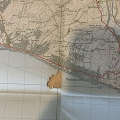
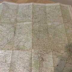


Ordnance Survey Map Eastbourne Sheet 183 One-Inch 1960 Vintage
USD 5.32 USD
Specifications
| Publication Year | 1960 |
| Type | Hiking Map |
| Publication Name | Collins Primary Atlas |
| Author | Ordnance Survey |
Eastbourne – Sheet 183. Covers Eastbourne, Bexhill, Lewes, Hailsham, Newhaven and surrounding Sussex coastline. Published 1960 (fully revised 1954–57). Map inside is complete and usable but has a couple of tears as shown in photos.
Related Items

Routemaster 2 Ordnance Survey Map 1:250000 Northern Scotland

OS Ordnance Survey Landranger Map – 2nd Series – Please select any available map
Aberystwyth and Machynlleth: Sheet 135 (… by Ordnance Survey Sheet map, folded

VINTAGE OS MAP OF CROMER AREA HERTFORDSHIRE DATED 1924 SIX INCHES TO ONE MILE

St Andrews & Kirkcaldy Ordnance Survey One Inch Map Sheet 560 Good condition

Surrey Outstanding Circular Walks (Pathfinder Guides) by Fiona Barltrop Book The

Ordnance Survey One Inch Tourist Map – Loch Lomond & The Trossachs (1967)

Ordnance Survey Vintage Cloth Map 1952 50s The Aldershot Guildford Free Post UK