




Ordnance Survey Map – Soil Survey Of Scotland – Land Use Capability – Stranraer
USD 33.62 USD
Specifications
| Series | Ordnance Survey |
| Publication Year | 1972 |
| Type | Geological Map |
| Format | Wall Map |
| Language | English |
| Region | Great Britain |
| Author | Ordnance Survey |
| Country | Scotland |
| Publisher | Ordnance Survey |
| Country Of Origin | United Kingdom |
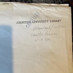
The Ordnance Survey Map of Scotland's Soil Survey, published in 1972, provides valuable information on land use capability in the Stranraer, Kirkmaiden, Whithorn and Wigtown regions. This geological wall map, authored by Ordnance Survey and printed in English, is a valuable tool for understanding the geography and geology of Great Britain. Made in the United Kingdom by Ordnance Survey, this map offers a detailed exploration of Scotland's terrain, making it a must-have for anyone interested in the region's natural features and land use patterns. The size of the map unfolded is approximately 118cm x 86cm. Ex Aberdeen University Library stock. Will be posted folded. Would look great framed and on the wall.
Related Items

Ordnance Survey (OS) 1:25,000 First Series Map Sheet 43/29 (SK 29) Stocksbridge

Lonely Planet Offbeat North America (Hardback) Lonely Planet (UK IMPORT)
Clapham Park & Balham 1872, 1894 or 1913 London Sheet 125

VINTAGE BARTHOLOMEWS ROAD MAP HEREFORD TOURISTS & CYCLISTS no 23

NEW Pelican Publishing Frenchmen, Desire, Good Children, LA 9781565549319 Trade

Go Here Instead: The Alternative Travel List by Dk Travel

Normandy Michelin Regional Map (Michelin National Map) by Michelin 206713521X
York County Pennsylvania Street Map ADC Of Alexandria 1980’s