
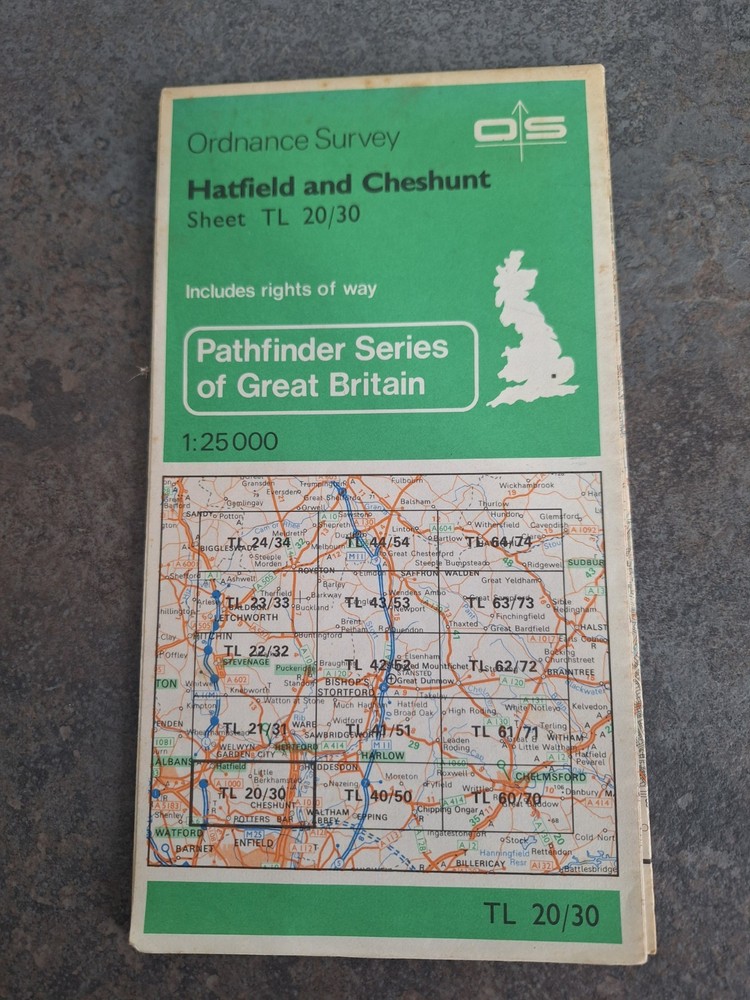

Ordnance Survey Pathfinder Map Hatfield & Cheshunt TL 20/ 30 1982 Sheet Map
USD 2.68 USD
Specifications
| Publication Year | 1982 |
| Series | Ordnance Survey |
| Type | Hiking Map |
| Language | English |
| Publication Name | Pathfinder Series |
| Country | United Kingdom |
| Region | Great Britain |
| Author | Ordnance Survey |
| Features | Folding Map |
| Map Scale | 1:25,000, 1:25,0 |
| Publisher | Ordnance Survey |
| Country Of Origin | United Kingdom |
This map is used but in very good condition The Ordnance Survey Pathfinder Map of Hatfield & Cheshunt TL 20/30 from 1982 is a detailed hiking map of Great Britain. Published by Ordnance Survey, the map is part of the Pathfinder Series and is in English. It features a folding map design at a scale of 1:25,000, making it an ideal tool for exploring the region of Hatfield and Cheshunt. With its accurate cartography and clear markings, this map is a valuable resource for outdoor enthusiasts looking to navigate the beautiful countryside of the United Kingdom.
Related Items
DOLGELLAU Ordnance Survey Map No 116 Seventh Ed 1962 Portmadoc Coed Y Brenin

Family Maps of Randolph County, Alabama, Deluxe Edition by Gregory a Boyd J D
5 x assorted Dorset Ordnance Survey Geographia maps Dorchester & Bournemouth

“Atlas of the Universe” by Mark A. Garlick, 2006

Insight Flexi Map: Iceland (Insight Flexi Maps) by Guides, Insight Sheet map The

The Times Map of the World (Fourth Edition, Bartholomew 1994).

Admiralty Charts Thames Estuary Bundle Small Craft Series Nautical Map Maritime

Taunton & Lyme Regis Ordnance Survey Cloth Map 1946 Sixth Series No 177