

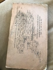
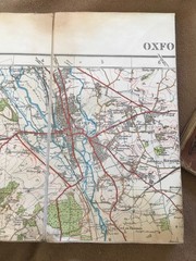


OXFORD & HENLEY on THAMES 1934 OS Popular Edition 1” Contoured Road Map
USD 9.37 USD
Specifications
| Publication Name | Ordnance Survey / Other |
| Publisher | Ordnance Survey |
| City | Oxford |
| Subject | Oxford |
| Series | Ordnance Survey |
| Publication Year | 1934 |
| Type | Map |
| Language | English |
| Author | Ordnance Survey / Other |
| Region | Great Britain |
| Country | United Kingdom, England |
| Country Of Origin | United Kingdom |
The OXFORD & HENLEY on THAMES 1934 OS Popular Edition 1” Contoured Road Map is a vintage Ordnance Survey map featuring the city of Oxford and surrounding areas. Published in 1934, this map is part of the Ordnance Survey series and is in English language. It provides detailed information on the roads and landmarks in the region, making it a valuable resource for historians, students, and anyone interested in the history of Oxford and the United Kingdom.
Related Items
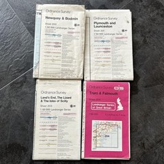
O S Power line and Obstruction overprint Cornwall 200, 201, 203, 204 1981-84
Rand McNally Road Atlas 2018: United – Paperback, by Rand McNally – Acceptable

National Geographic Atlas Of World History HardCover Book 1997 Leather Deluxe Ed

Market Drayton 1900 Shropshire Sheet 16.02 by Barrie Trinder
Michelin USA Canada Mexico – 2026 Road Atlas (A4-Spir (Spiral Bound) (UK IMPORT)

Vintage Schwarzers Düsseldorf Fold Out Wall Map Tourist Guide + Erotic Adverts

Imray C65 Crinan to Mallaig and Barra Chart 1:155000 Scale – 2003

A Pebble In The Throat: Growing Up Between Two Contin… by Mir, Aasmah Hardback