
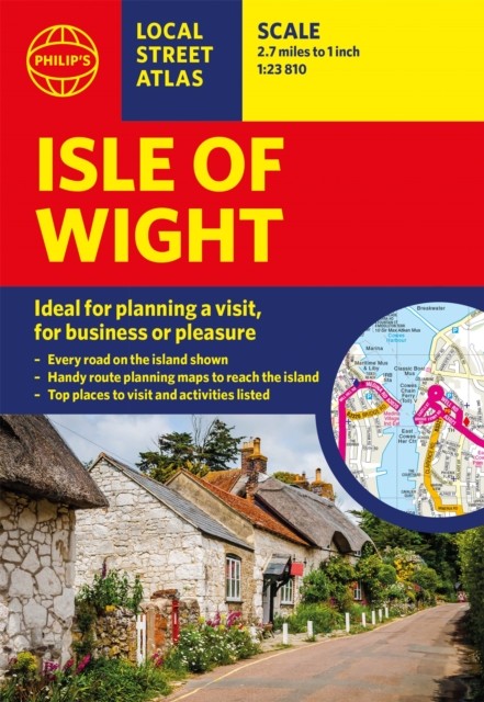


Philip’s Isle of Wight Guide Book by Philip’s Maps (Paperback Book)
USD 11.15 USD
Specifications
| Author | Philip's Maps |
| Publication Year | 2022 |
| Format | Paperback |
| Language | eng |
| Country Of Origin | China |
| Item Height | 0.8 cm |
| Item Length | 14.1 cm |
| Item Weight | 130 g |
| Item Width | 20.6 cm |
| Publication Name | Not Available |
| Type | Not Available |
| ISBN | 9781849076104 |
This pocket-sized street atlas of the Isle of Wight gives detailed coverage of the whole of the island. This local street atlas of the Isle of Wight gives detailed coverage of the whole of the island at a scale of 2 2/3 inches to 1 mile. Important for ferry links to the Isle of Wight, the mainland towns of Southampton, Gosport, Lymington and Portsmouth are included at the same scale. Central Portsmouth is also shown at the enlarged scale of 5 1/3 inches to 1 mile. Full of useful tourist information and all the sights and activities available on the Isle of Wight, the maps also show hospitals, car parks, post offices, leisure facilities, schools, industrial areas and retail areas, while the index lists street names and postcodes.
Related Items

Genealogy Family Maps Nacogdoches County Texas

New Concise World Atlas Hardcover

Explorer’s Guide Chesapeake Bay: A Great Destination by Blake, Allison

Lonely Planet A Year of Festivals: How to Have the Time of Your Life

Madagascar, Automap 1:1.000.000 by Freytag-Berndt (Sheet map, folded)
Small Island: 12 Maps That Explain the History of Britain by Parker, Philip
GRAVESEND Street plan with index – by Barnett’s circa 1963

The Death of Us by Abigail Dean (Hardback Book)