


Philip’s Navigator Street Atlas Cheshire by Philip’s Maps (Spiral bound)
USD 19.90 USD
Specifications
| Author | Philip's Maps |
| Publication Year | 2022 |
| Format | Spiral bound |
| Language | eng |
| Country Of Origin | United Kingdom |
| Item Height | 1.8 cm |
| Item Length | 19.5 cm |
| Item Weight | 612 g |
| Item Width | 27.0 cm |
| Publication Name | Not Available |
| Type | Not Available |
| ISBN | 9781849075985 |
The only atlas with all the named streets in Cheshire. CHESTER, CREWE, MACCLESFIELD, NORTHWICH, RUNCORN, WARRINGTON, ALDERLEY EDGE, ALSAGER, AUDLEM, CONGLETON, ELLESMERE PORT, FRODSHAM, HELSBY, HOLMES CHAPEL, KELSALL, KNUTSFORD, LYMM, MALPAS, MIDDLEWICH, NANTWICH, NESTON, POYNTON, SANDBACH, TARPORLEY, WIDNES, WILMSLOW, WINSFORD. Routinely used by the emergency services and perfect for the professional driver, the street maps show every named road, street and lane very clearly, with major roads picked out in colour. The route planner shows all the A and B roads and can be used to get close to the destination before turning to the relevant large-scale street map.
Related Items
CLOTH Ordnance Survey One-Inch Map 174 BUDE New Popular 6th Edition 1946
Ordnance Survey One Inch Map – Boston & Skegness – Sheet 114 – 1962

Go Here Instead
Ordnance Survey (OS) 1:25,000 First Series Map Sheet ST 91 Tollard Royal

OS, Ordnance Survey Landranger map- no: 116, Denbigh & Colwyn Bay
Tavistock 1905 Devon Sheet 105.08 by Tom Greeves
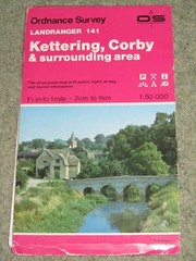
Ordnance Survey Landranger 1:50,000 sheet 141 Kettering & Corby – 1987

DK Atlas of the World 2006 Ed. Dorling Kindersley