


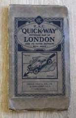


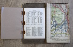

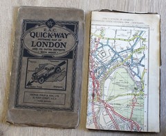
RAC Quickway Motoring Map of LONDON & Outer Districts Fold Out Colour Transport
USD 40.42 USD
Specifications
| City | London |
| Publisher | George Philip |
| Subject | Geography & Geosciences |
| Publication Year | 1950 |
| Type | Map |
| Format | Cloth Book |
| Unit Type | Unit |
| Language | English |
| Item Height | 111 cm |
| Region | Europe, Great Britain |
| Country | England |
| Author | George Philip |
| Features | Folding Map |
| Country Of Origin | United Kingdom |
| Item Weight | 300 g |
| Item Width | 47 cm |
And its outer districts. R.A.C. Motoring Map of. Fold out map. Colour cloth backed. Double sided map. 111 cm x 47 cm each side. Staples rusted.
Related Items

Glasgow Atlas, Geographia Ltd paperback
The Lifeboat Glossary with Diagram WT Harris, printed Liverpool 3rd edition 1953

Ordnance Survey Explorer Map 1:25,000 391 Ardgour & Strontian (CURRENT)

Ordnance Survey Vintage Cloth One-Inch Map of Oxford and Newbury Published 1948
Travellers Mediterranean Cruising (Travellers – Thomas Cook) By

David Brawn Ibiza Tour and Trail Map (Map)

Philip’s Local Explorer Street Atlas Somerset by Philip’s Maps (Spiral bound)

Scarborough, Bridlington and Flamborough Head (Map) OS Explorer Active Map