
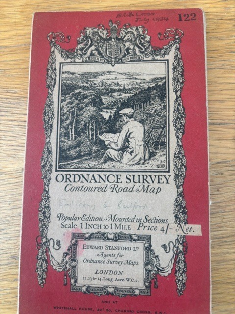
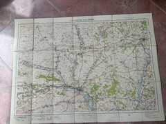
SALISBURY & BULFORD NORTH WILTSHIRE ORDNANCE SURVEY MAP 1931
USD 9.08 USD
Specifications
| Publication Year | 1931 |
| Series | Ordnance Survey |
| Type | Cloth Map |
| Format | Cloth Map |
| Language | English |
| Country | England |
| Region | Wiltshire |
| Features | Folding Map |
| Publisher | Ordnance Survey |
Sheet 122. Nice old cloth Ordance survey one inch to one mile map. Imber top left, Hatherden top right, Alvediston bottom left, Timsbury bottom right. Measures 30 x 22 inches approx. Free UK postage
Related Items

HAMMOND DISCOVERY WORLD ATLAS By Hammond Incorporated **Good Condition**

Retirement on a Shoestring, 5th (Choose Retirement Series) – Paperback – GOOD
Ordnance Survey Landranger Map – Worcester & The Malverns – Sheet 150 – 1997

Adirondack High : Images of America’s First Wilderness by Hardie Truesdale,…

Beacon Guidebooks Backcountry Sled-Skiing Buffalo Pass Colorado Atlas 2020 Off-…
Lofoten to Spitsbergen | NGA Chart 43000

Ordnance Survey One Inch First Edition Reprint Map HUDDERSFIELD & MANCHESTER-21

CONCISE HISTORICAL ATLAS OF WORLD WAR TWO:THE GEOGRAPHY OF CONFLICT – paperb…