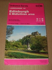
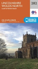
Southport & Chorley, Wigan Formby & Ormskirk Ordnance Survey OS Explorer Map 285
Specifications
| Return Postage Will Be Paid By | Buyer |
| Returns Accepted | Returns Accepted |
| After Receiving The Item, Your Buyer Should Cancel The Purchase Within | 30 days |
| Publisher | Ordnance Survey |
| Country/Region Of Manufacture | United Kingdom |
| Author | Ordnance Survey |
| Language | English |
| Format & Map Type | Sheet Map, Folded |
| Date Of Publication | 2007 |
| Publication Name | Ordnance Survey |
| Subject | N/A |
| Type | Geological Map |
Ben's Warehouse online sales and auctions Southport & Chorley Wigan, Formby & Ormskirk Ordnance Survey (OS) Map Explorer Sheet 285 Summary and Condition This item is for an Ordnance Survey Explorer map of Southport, Chorley, Wigan, Formby & Ormskirk, published in 2007. The map has never been used and the sheet is therefore in as new condition. Refer to photographs. Please do not hesitate to contact me should you have any queries. I have a large number of maps available, please contact me if you require a map that is not listed as I may have it in stock. Kind Regards, Ben. Accepted forms of Payment: PayPal, Skrill, bank transfer, cheque or postal order. Edition Details Edition: A1 Crown Copyright: 2007 Revised: 2000 Revised for selected change: 2004 Reprinted with minor change: 2007 Scale: 1:25 000 or 4cm to 1km (2.5 inches to 1 mile) Featured on this Map Places features on this map:Adlington, Ainsdale, Banks, Billinge, Bretherton, Brinscall, Burscough, Chorley, Croston, Eccleston, Formby, Great Altcar, Halsall, Hightown, Leyland, Lydiate, Maghull, Mere Brow, Ormskirk, Orrell, Parbold, Pinfold, Rainford, Rufford, Scarisbrick, Shevington, Skelmersdale, Southport, Standish, Tarleton, Whittle-le-Woods, Wigan The Mersey ForestThe Red Rose Forest Recreational Paths:1)Cheshire Lines Walk2)Sefton Coastal Footpath3)Trans Pennine Trail
Related Items