

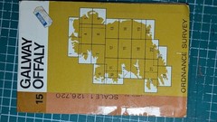


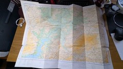
Vintage Ordnance Survey Irish Map – Offaly (15) 1978
USD 8.06 USD
Specifications
| Binding | Sheet map, folded |
| Artist | Ordnance Survey Ireland |
| Publisher | Ordnance Survey |
| Subject | Transportation |
| Publication Year | 1978 |
| Type | Travel Maps |
| Format | Sheet Map |
| Language | English |
| Author | Ordnance Survey Ireland |
| Country | Ireland |
| Region | Offaly |
| Features | Folding Map |
| Map Scale | 1:126,720 |
| Country Of Origin | Ireland |
This vintage Ordnance Survey Irish map of Offaly from 1978 is a detailed sheet map folded in a convenient format. Created by Ordnance Survey Ireland, it is part of the Discovery Series and features a map scale of 1:126,720, making it ideal for transportation and travel purposes. The map showcases the region of Offaly in Ireland, offering a comprehensive visual guide for exploring the area. With its historical significance and practical use, this map is a valuable resource for anyone interested in Irish geography and transportation.
Related Items

Rand McNally Rand McNally Folded Map: Nashville Street Map (Map)

Collins Britain & Ireland 2014 Handy Road Atlas Spiral bound Maps Roadcheck Taxi

Historical Atlas of the World – Paperback, by Rand McNally – Very Good

Bensons MapGuides The Handy London Map & Guide City Map Paperback 2015 Easy USE
OS Landranger Ordnance Survey Maps Bundle x 8

Make The Most Of Your Time On Earth (Compact edition) (Rough Guide Make t – GOOD

A Guide To Your National Forests Pamphlet/Map

OS Explorer Map 168 Stroud, tetbury & malmsbury