



Vintage Ordnance Survey Peak District Tourist Map National Park OS
USD 13.44 USD
Specifications
| Publisher | Ordnance Survey |
| Subject | Geography & Geosciences |
| Series | Ordnance Survey |
| Publication Year | 1972 |
| Type | Hiking Map |
| Format | Folding Map |
| Language | English |
| Author | Ordnance Survey |
| Country | United Kingdom, England |
| Region | Great Britain |
| Country Of Origin | United Kingdom |
Vintage Ordnance Survey Peak District Tourist Map showing the National Park boundary. A folded OS tourist map covering the Peak District, including Buxton, Bakewell, Edale, Kinder Scout, Mam Tor, Matlock, Glossop and surrounding areas. Good vintage condition with age related wear. There is creasing, light edge wear and some corner wear to the covers from use and storage. The map remains complete.
Related Items

Market Weighton and Yorkshire Wolds Cent… by Ordnance Survey Sheet map, folded

Psiloritis (Mount Ida) (Map) (UK IMPORT)

AA Street by Street Derby, Leicester, Nottingham Paperback / softback Book The

The Robert Louis Stevenson Trail: The GR70 from Le Puy – St-Jean-du-Gard. 2nd ed

Ordnance Survey Landranger Map – Ludlow & Wenlock Edge, Sheet 137 – 1980

The Nystrom Desk Atlas by Nystrom: New
1990 Ordnance Survey Pathfinder Map 103 NC 20/30 Cromalt Hills And Glen Oykel
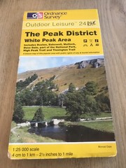
Ordnance Survey Outdoor Leisure Map 24 – Peak District – White Peak Area