


Vintage OS Landranger Maps Bundle: Chichester, Bournemouth, Saxmundham 1:50k
USD 10.76 USD
Specifications
| Publisher | Ordnance Survey |
| Series | Ordnance Survey |
| Publication Year | 1940 |
| Type | Geological Map |
| Format | Paperback, Pamphlet |
| Language | English |
| Country | United Kingdom |
| Region | Great Britain |
| Author | Ordnance Survey |
| Country Of Origin | United Kingdom |
Dive into Britain’s stunning landscapes with this vintage bundle of three Ordnance Survey Landranger maps! Perfect for avid hikers, history buffs, or collectors, these classic pink-covered editions at 1:50,000 scale offer detailed trails, footpaths, and tourist info for Chichester & The Downs (Sheet 197), Bournemouth & Purbeck including Wimborne Minster & Ringwood (Sheet 195), and Saxmundham, Aldeburgh & Southwold (Sheet 196). From coastal walks along the Suffolk shores to the rolling South Downs and Jurassic Coast adventures, these maps unlock endless exploration. In good used condition with minor wear—ready to inspire your next outdoor quest or frame as nostalgic decor. Grab this trio before it’s gone!
Related Items

National Geographic Concise Atlas of the World, Third Edition: The Ultimate

Anafi (Map) (UK IMPORT)

Lonely Planet Ultimate Australia Travel List: 500 Amazing Experiences Ranked…

Perth Street Guide: Almondbank, Balbeggie, Bankf… by Val Fry Sheet map, folded

Vintage Cloth Map Bartholomews Half Inch Sheet 8 Salisbury Plain

Vintage OS Ordnance Survey Maps London Malvern Aldershot Peterborough Winchester

Feckin’ Tour of Ireland : 50 Must-Do Things, Hardcover by Murphy, Colin; O’re…
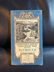
Ordnance Survey One Inch Fifth Edition Map 144 Plymouth, 1934