
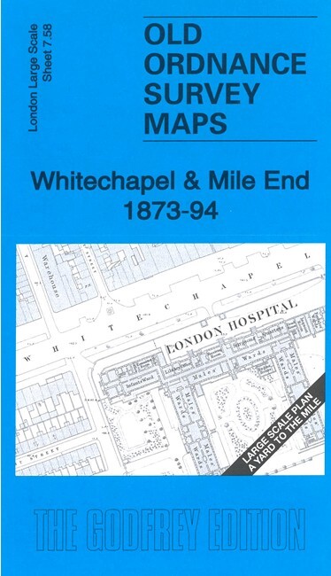
Whitechapel & Mile End 1873-94 London Large Scale Sheet 7.58 by Pamela Taylor
USD 5.05 USD
Specifications
| Publication Year | 2024 |
| Type | Street Map/Directory |
| Author | Pamela Taylor |
| Publisher | Alan Godfrey Maps |
| Topic | Local History |
| Subject | History |
| Country Of Origin | United Kingdom |
This very detailed map covers Whitechapel and part of Mile End. It is double-sided, with the 1873 map on one side and a reduced version of the 1894 map on the reverse. We also include an introduction to the history of the area. Features (from 1871 map) include London Hospital, Whitechapel Road, part of Whitechapel workhouse, St Philip's church, Trinity Almshouses, schools, chapels, chemical works etc. The 1894 map shows the two Whitechapel stations, Albion Brewery and tramways.
Related Items

HarperCollins Atlas of World History Hardcover World Region History Atlas

Vintage Ordnance Survey Map Sheet 102 Preston And Blackpool First Series

MAP OF Sidcup (& Foots Cray) 1908 Kent Sheet 8.11 NEW

British Mountain Trail Map Skye Trail Walking Path Route Waterproof Harvey Maps

Brecon Beacons National Park / Parc Cenedlaethol Bannau Brycheiniog – Eastern

Ware 1896 Hertfordshire Sheet 29.12 by Alan Godfrey

SP Maps Street Plan and Guide To The City Of Southampton Including Totton
Street Map of WAREHAM and surrounding district