
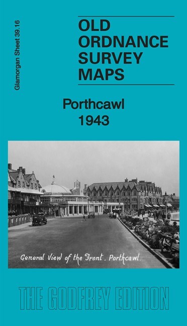
Porthcawl 1943 Glamorgan Sheet 39.16 by Alan Godfrey
USD 4.95 USD
Specifications
| Type | Street Map/Directory |
| Author | Alan Godfrey |
| Publisher | Alan Godfrey Maps |
| Topic | Local History |
| Subject | History |
| Country Of Origin | United Kingdom |
| ISBN | 9781787212169 |
This detailed map gives excellent coverage of Porthcawl, which was developed as coal-shipping port in the mid 19th century and, when this failed, grew into a major seaside resort. In 1943 it was busy with American and British soldiers, many of them billeted here as they prepared for the Normandy landings. Features on the map include town centre with individual buildings neatlyn shown, railway with station, Harbour, Esplanade Hotel, Sea Bank Hotel, Grand Pavilion, cinemas, All Saints Church, Congregational Church, railway sidings and layout, Coney Beach Amusement Park, Porthcawl Sands, Rhych Point, Newton Burrows. Part of Newton village is in the top right corner.
Related Items

Road Map South East England (AA Road …, AA Publishing) 2007

Sparkhill & Greet 1887, 1903, 1913 or 1938 Warwickshire Sheet 14.14

BOWLAND FOREST River Loud Ordnance Survey Sheet 34/64 1:25000 1946 National Grid

Great British Marvellous Map of Wonders | Adventure Maps & Guides | Days Out

Ordnance Survey Pathfinder map sheet SS 43/53 Barnstaple & Braunton – 1984

Sarah Quail Old Portsmouth and Gosport 1896 (Map) (UK IMPORT)
OS Map of Newquay & Padstow 1:25,000 Explorer series – Sheet 106

1994 Ordnance Survey Landranger Map 153 Bedford & Huntingdon (incl St Neots )