
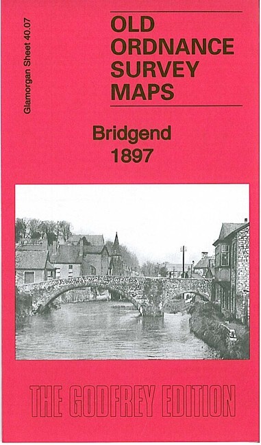
Bridgend 1897 Glamorgan Sheet 40.07 by Derrick Pratt
USD 5.11 USD
Specifications
| Type | Street Map/Directory |
| Author | Derrick Pratt |
| Publisher | Alan Godfrey Maps |
| Topic | Local History |
| Subject | History |
| Country Of Origin | United Kingdom |
| ISBN | 9781847844972 |
This detailed map covers the town of Bridgend and the area to the west. Coverage extends from Bridgend station westward to Broadland Fach. Features include railway with station, Ogmore River, St Mary's church, Oldcastle area, Brewery, Newcastle area, Cefn-glas House, Bridgend & Cowbridge Workhouse, town centre with individual buildings neatly shown, St Illtyd's church, bridges, Tannery, schools, Ystrad Fawr etc. On the reverse we include a list of private residents and churches from a 1906 directory.
Related Items

BERWICK UPON TWEED – Ordnance Survey Landranger Map

Merton 1894 London Sheet 142

Vintage Ordnance Survey 7th series maps, long matt covers, choose one or more

OS Ordnance Survey 1″ Seventh Series 107 Snowdon – 1953 edition on cloth
South Pennines by Ordnance Survey (Sheet map, 1996) List 470 Needs Taping

Collins Discovery Guides – Night Sky Northern Hemisphere + FREE P&P

Robert Woodhouse Stockton-on-Tees and Thornaby 1897 (Map) (UK IMPORT)

Ordnance Survey 6 inch -1 mile map Kirtleton, Dumfriesshire 1947