
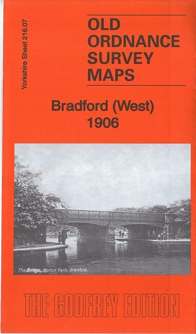
Bradford (West) 1906 Yorkshire Sheet 216.07 by Ruth Strong
USD 5.04 USD
Specifications
| Type | Street Map/Directory |
| Author | Ruth Strong |
| Publisher | Alan Godfrey Maps |
| Topic | Local History |
| Subject | History |
| Country Of Origin | United Kingdom |
| ISBN | 9781787210981 |
This detailed map covers an area just west of Bradford city centre, with coverage extending from Dirk Hill and Legrams Mill westward to Scholemoor and Paradise Green. Lidget Green is in the centre of the map. Features include Crossley Hall Dye Works, Scholemoor Cemetery, Paradise Green, Lidget Green, Victoria Dye Works, Beck Side Mills, St Wilfrid's church, Horton Iron Works, Alston Works, tramways, Bentley Mills, Legrams Mill, GNR City Branch, Dirk Hill, St Columba's church, part of Horton Park, GNR Bradford & Thornton railway with Great Horton station, Sellers Fold, Cannon's Mill etc. Extracts from a 1912 street directory are included on the reverse.
Related Items

Bricklayers Arms Station 1871 London Large Scale Sheet 11.06 by Alan Godfrey

Philip’s Key Events in History – People, Dates & Events, 2nd edition

VINTAGE GEOLOGICAL MAP PICKERING N YORKSHIRE SHEET 53 GEOLOGICAL SURVEY 1960
Bedworth 1923 Warwickshire Sheet 17.05 by Barrie Trinder
Nautical Instructional map Dover Strait 5052 1:200,000 1977 with corrections
OS Ordnance Survey Landranger Map Sheet 91 Appleby – 1982

Linthorpe & South Middlesbrough 1928 Yorkshire Sheet 16.02 by Alan Godfrey NEW

Reading 1898: Berkshire Sheet 37.03 (Old O.S… by Parry, R.B. Sheet map, folded