
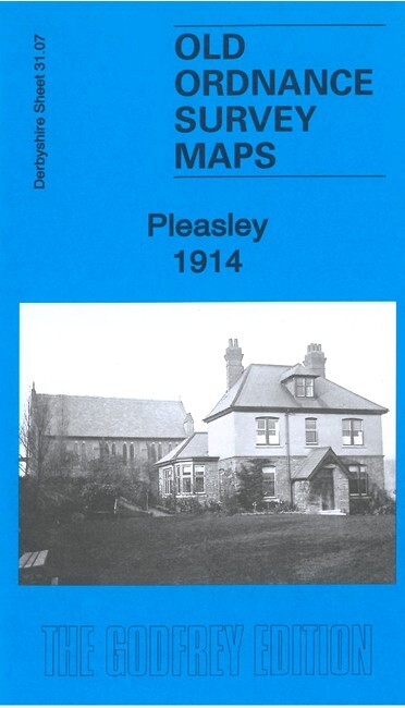
Pleasley 1914 Derbyshire Sheet 31.07 by Barrie Trinder
USD 5.04 USD
Specifications
| Publication Year | 2021 |
| Type | Street Map/Directory |
| Author | Barrie Trinder |
| Publisher | Alan Godfrey Maps |
| Topic | Local History |
| Subject | History |
| Country Of Origin | United Kingdom |
| ISBN | 9781787214545 |
This detailed map covers the villages of Pleasley and Pleasleyhill on the Derbyshire/Nottinghamshire border. The map is double-sided to give maximum coverage, and includes part of adjacent sheet 31.08 covering Pleasley Vale. Features include Pleasley Colliery, GNR Leen Valley Extension Railway, Midland Railway Tibshelf & Pleasley line, stations on both lines, St Michael's church, Pleasleyhill Farm, Pleasley Mill, Radmanthwaite, Upper and Lower Mill, Pleasley Works, Meadow Houses, St Chad's Chapel, Little Matlock, Pleasley Vale Sidings etc.
Related Items
Vintage Bartholomew Survey Map Of Great Britain Sheet 13 Wye Valley

OS Ordnance Survey Landranger Map 1985, Sheet 128, DERBY & BURTON UPON TRENT

Assorted OS maps – one map per order

Philip’s Modern School Atlas: 91st Edition – Vintage Collectable Genuine Atlas

MAP OF Leeds (Lower Briggate & Riverside) 1847 Leeds Large Scale Sheet 15 NEW

Admiralty Small Craft Chart 5616_27: Isle of Mull to Isle of Lewis

5 x UK Ordnance Survey Road Maps Vintage 1970s/70s Inc. Lands End & Torquay. VGC

Maidstone & the Medway Towns, OS Explorer Map 148, 1:25 000 scale