

Malvern Link 1926 Worcestershire Sheet 40.05 by Alan Godfrey
USD 5.00 USD
Specifications
| Type | Street Map/Directory |
| Author | Alan Godfrey |
| Publisher | Alan Godfrey Maps |
| Topic | Local History |
| Subject | History |
| Country Of Origin | United Kingdom |
| ISBN | 9781841518336 |
This detailed map covers most of Malvern Link, with coverage extending from Albert Park Road northward and eastward to St Leonard's church, Newland. Features include railway with station, Upper Howsell, Quest Hills, St Cuthbert's school, saw mill, laundry, Link Farm, motor works, St Matthias church, Worcester Road area, St Leonards and convent, Beauchamp Almshouses, Newland, The Grange, St Leonard's church. On the reverse we include a selection of street directory entries, incl Church Road, Howsell Road, Pickersleigh Road, Richmond Road, Worcester Road.
Related Items

Stonefield, Auchinraith & Burnbank 1897 Lanarkshire Sheet 11.15 by Gilbert Bell

1 12 13 14 BRECON BEACONS WYE VALLEY DEAN FOREST OL ORDNANCE SURVEY MAPS OS LOT

Stephen Humphrey Bermondsey and Wapping 1872 (Map) (UK IMPORT)
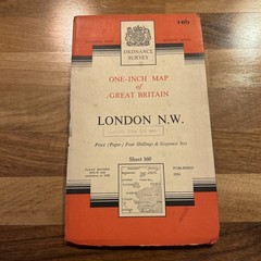
LONDON NORTH WEST Ordnance Survey Map 1958 Sheet 160 Seventh Series St Albans

Ordnance Survey. Fort Augustus. Sheet 34. Landranger Series. Map. 1:50 1980

OS MAP BRISTOL & STROUD 156 SEVENTH SERIES ONE INCH MAP 1958 ORDNANCE SURVEY

Ordnance Survey Map Preston and Blackpool Tourist Collectable Vintage ra

South Huntingdonshire 1897 One Inch sheet 187 by David Cozens