
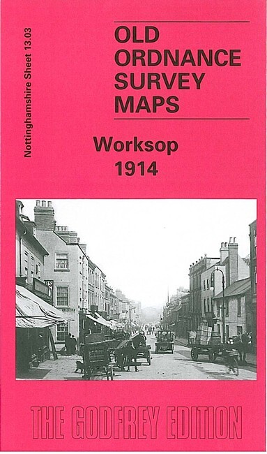
Worksop 1914 Nottinghamshire Sheet 13.03 by John Griffiths
USD 5.04 USD
Specifications
| Type | Street Map/Directory |
| Author | John Griffiths |
| Publisher | Alan Godfrey Maps |
| Topic | Local History |
| Subject | History |
| Country Of Origin | United Kingdom |
| ISBN | 9781841512389 |
This very detailed map covers the centre and east of Worksop, with coverage extending from Cresswell Street eastward to the Cemetery and Retford Road, and from Park Street northward to the station. Features include GCR railway with station, St John's church, malthouses, brewery, Workhouse, town centre in detail with individual buildings neatly delineated, Market Place, St Mary & St Cuthbert's church, Priory remains, Bracebridge area, Manton Colliery Village, Kilton, Chesterfield Canal, schools etc. On the reverse we include entries A-M from a 1914 directory
Related Items

Geographia Bounemouth and Poole Detailed Street Plan Vintage Map
OS Landranger 44 Map (Ballater & Glen Clova)
Vintage OS Ordnance Survey 1″ map – Sheet 139 Cardigan, 1967 edition

Adam Selzer Murder Maps USA (Hardback)

Oldham (SW) 1891 or 1916 Lancashire Sheet 97.09

Oxford In Your Pocket, Intermap Pocket Atlas & Guide 1989 Paperback

VINTAGE BARTHOLOMEW’S MAP NEW FOREST NO 5 REVISED HALF-INCH CONTOURED CLOTH 1949

FIRTH OF CLYDE 1965 paper Ordnance Survey Quarter Inch Map Sheet 6 Arran