


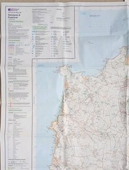


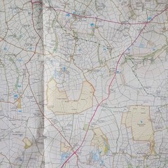


Ordnance Survey Explorer Map 106: Newquay & Padstow (2008).
USD 7.40 USD
Specifications
| Series | Ordnance Survey |
| Publication Year | 2008 |
| Type | Explorer Map |
| Format | Folding Map |
| Language | English |
| Country | England |
| Map Scale | 1:25,000 |
| Publisher | Ordnance Survey |
| Country Of Origin | United Kingdom |
Ordnance Survey Explorer Map 106: Newquay & Padstow including Wadebridge, Port Issac & St Columb Major (2008). Showing part of the South West Coast Path. This map is in very good condition for its year with no pen, pencil marks, highlighting or tears. There's slight wear along the folds. The cover has surface wear and slight creasing on both sides, along the edges and corners. Overall, the map sheet is in better condition than the cover. Please see all photo's.
Related Items

Spain Camino de Santiago pack of 11 maps (brown paper) pilgrimage walking hiking

The Pocket Butler’s Guide to Travel: Essential Advice for Every Traveller, from
Antique Scarce Map- JOHNSTON – Motoring Cycling Hiking ,Carlisle Lancaster
Jan Kostura Rhodes Tour and Trail Map (Map)
Agricultural Land Classification of England and Wales, Sheet 97, 1960

Leeds (Lower Briggate & Riverside) 1847 Leeds Large Scale Sheet 15

Ordnance Survey Explorer 126 Clovelly & Hartland (Bideford & Bradworthy) 1:25000

Vintage Ordnance Survey One Inch Teesdale 1964 Map Sheet 84 Cloth