
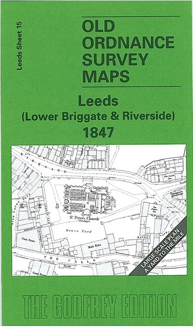
Leeds (Lower Briggate & Riverside) 1847 Leeds Large Scale Sheet 15
USD 5.04 USD
Specifications
| Publication Year | 2005 |
| Type | Street Map/Directory |
| Author | G C Dickinson |
| Publisher | Alan Godfrey Maps |
| Topic | Local History |
| Subject | History |
| Country Of Origin | United Kingdom |
| ISBN | 9781841518015 |
This wonderfully detailed map covers the area around Lower Briggate and extends across the River Aire to show Meadow Lane, Bridge End, South Brooke Street and Wilson Street. Major features include St Peter's church, Christ Church, Salem Chapel, Friends Meeting House, White Cloth Hall, Leeds Bridge, Crown Point Bridge, Aire & Calder Dock, Boar Lane, warehouses, The Calls, Kirkgate, South Market and much more. On the reverse we include a selection of street directory entries, incl Boar Lane, Briggate, Call Lane, East Street, Kirkgate.
Related Items

Ordnance Survey SNOWDON – Sheet 107 – 1953
East Ham & Barking South 1915 Essex Sheet 86.07 by Tony Clifford & Alan Godfrey
Vintage 1964 Philips Secondary School Atlas COMP. Cold War USSR Soviet Scotland

Southport & Chorley, Wigan Formby & Ormskirk Ordnance Survey OS Explorer Map 285

ORDNANCE SURVEY Sheet SS82 SOMERSET / DEVON Provisional Ed. OS Map M172

Under Earth, Under Water – Mizielinski, Aleksandra and Daniel large HB book

Ordnance Survey Pathfinder map sheet 529 (XG 87/97) Dumfries – 1987

Antique OS Ordnance Survey Vintage Edition Map Of , GUILDFORD HORSHAM 1925