
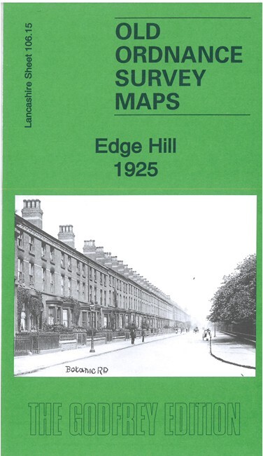
Edge Hill 1925 Lancashire Sheet 106.15b by Kay Parrott
USD 5.04 USD
Specifications
| Publication Year | 2022 |
| Type | Street Map/Directory |
| Author | Kay Parrott |
| Publisher | Alan Godfrey Maps |
| Topic | Local History |
| Subject | History |
| Country Of Origin | United Kingdom |
| ISBN | 9781787215535 |
The maps cover a busy area of Liverpool, from Crown Place and Mount Vernon Green eastward to Picton Road and Wavertree station. Features (on 1925 map) include Edge Hill station with many railway lines, goods station, Engine Shed, Goods & Cattle station, Wavertree station, sorting sidings, tramways, Wapping Tunnel, St Mary's church, St Anne's RC church, public baths, Phoenix Safe Works, Pavilion Theatre, Orphan Asylum, St Stephen's church, Victory Machine Works, Edgehill Training College, Wavertree Park, St Hugh's RC church, St Dunstan's church, Fairfield Biscuit Works, Confectionery Works, St Bridget's church, Liverpool Dogs Home, etc.
Related Items

Great World Atlas by Dorling Kindersley Publishing Staff (2006, Hardcover)
MAP OF Bromsgrove 1926: Worcestershire Sheet 15.16 by Malcolm Nixon NEW
Smethwick 1938: Staffordshire Sheet 72.0… by Trinder, Barrie Sheet map, folded
OS 128 Ordnance Survey Landranger Map Derby & Burton on Trent area – 1991 VGC

MAP OF THE SHELFORDS 1901 CAMBRIDGESHIRE SHEET 54.02 NEW 9781787219496

VINTAGE David and Charles Map Sheet KENDAL LAKE DISTRICT, original Packaging

Kensington (Earls Court Road) 1865-94 London Large Scale 6.98 by Alan Godfrey

Isle of Wight (Sheet map, folded)