
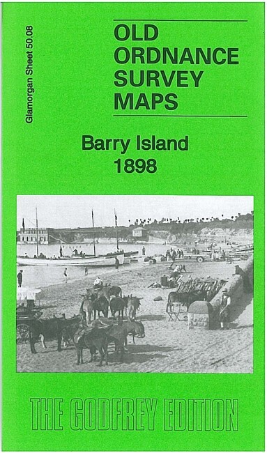
Barry Island 1898 Glamorgan Sheet 50.08 by Derrick Pratt
USD 5.04 USD
Specifications
| Type | Street Map/Directory |
| Author | Derrick Pratt |
| Publisher | Alan Godfrey Maps |
| Topic | Local History |
| Subject | History |
| Country Of Origin | United Kingdom |
| ISBN | 9781847846167 |
This detailed map covers most of Barry Island, part of Barry itself and part of the docks. Features include Barry station, Barry Island station, Barry Pier station, many mineral lines, and sidings, Romilly Park, Cold Knap Farm, Cold Knap Point, St Nicholas church, Ewe Rocks, Barry Harbour, Wickmoor Bay, Nell's Point, St Baruch's Chapel, Dock No.3, part of Dock No.1, commercial graving dock, Castle Farm, Switchback Railway, etc. A 1906 directory is included on the reverse.
Related Items

Dumbarton 1897 Dumbartonshire Sheet 22.06 by Gilbert Bell

Bricklayers Arms Station 1871 London Large Scale Sheet 11.06 by Alan Godfrey

Bartholomew’s Quarter Inch Map of Ireland – Sheet 4 Cork and Killarney
York Leeds Reprint Of First Edition 1 Inch Ordnance Survey Map 8961F

Grays (NE) 1916 Essex Sheet 95.03 by Tony Kirby

Bermondsey (West) & Bricklayers’ Arms 1872-93 London Large Scale 7.96

WITHAM & TIPTREE Street plan with index – by Barnett’s circa 1970’s

IPSWICH THE NAZE No 169 1974 39783 1.500 000 First Series Ordnance Survey Map