
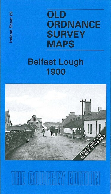
Belfast Lough 1900 Irish One Inch Sheet 29 by Alan Godfrey
USD 4.69 USD
Specifications
| Type | One Inch Map |
| Author | Alan Godfrey |
| Publisher | Alan Godfrey Maps |
| Topic | Local History |
| Subject | History |
| ISBN | 9781847843333 |
This map covers an area either side of Belfast Lough, with part of Co Antrim to the north, Co Down to the south. Coverage stretches from Ballycarry southward to Conlig, and from Holywood eastward to the Copeland Islands.
Related Items

Vintage Ordnance Survey One Inch Cloth Map, Bristol & Newport, 155, 1946
MAP OF Malvern The Wyche 1926 Worcestershire Sheet 39.16 by Malcom Nixon NEW

Dartmoor 1908 One Inch Sheet 338 by Tom Greeves

Nick Burton Bolton (North) 1908 (Map) Old O.S. Maps of Lancashire
Lockerbie 1898 Dumfriesshire Sheet 51.01 by Alan Godfrey

Canterbury & Ashford 1888 One Inch Sheet Barrie Trinder
Radcliffe on Trent 1899 Nottinghamshire Sheet 43.05 by Barrie Trinder

Birmingham (West) 1914 by Alan Godfrey (Sheet map, folded)