
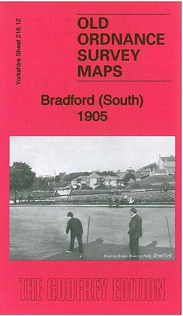
Bradford (South) 1905 Yorkshire Sheet 216.12 by Ruth Strong
USD 5.04 USD
Specifications
| Type | Street Map/Directory |
| Author | Ruth Strong |
| Publisher | Alan Godfrey Maps |
| Topic | Local History |
| Subject | History |
| Country Of Origin | United Kingdom |
| ISBN | 9781847847973 |
This detailed and busy map covers the south part of Bradford, including West Bowling and part of East Bowling. Features include Bowling Park, GNR railway with Bowling Junction and station, Bowling Cemetery, Bowling Hall, Staygate, Newhall, Bowling Dye Works, Woodroyd Brick Works, Rooley, Woodroyd House, tramways, Prospect Mills, St Matthew's church, Bankfoot Mills, Craven Heifer Inn, Rooley Hall, Chapel Green, Briggella Mills, Holme Top Mills Towers Hall, St Stephen's church, St Stephen's Shed, schools, Bowling Soap Works, Parkside Mills, chapels, library, Woodroyd Shed etc. A selection of street directory entries is included on the reverse.
Related Items

Vintage 1980’s Bartholomew, Midlands, GT Series Map

Loch Rannoch Ordance Survey map Sheet no 42 (special library edition)
Vintage UK & Ireland Maps Bundle – OS, Shell, Collins, Street Plans

Greenford 1894: Middlesex Sheet 15.07a (… by Hounsell, Peter Sheet map, folded
![Macedonia Central Greece [2] Terrain Editions Touring Map 1:200,000 NEW](https://yeymaps-support.com/images/W64AAeSwDeVp91-m/macedonia-central-greece-2-terrain-edi-240.webp)
Macedonia Central Greece [2] Terrain Editions Touring Map 1:200,000 NEW

Amazing Cond IMRAY Folding Map C48 LA CORUNA TO PORTO (Spain & Portugal)

OS Ordnance Survey Landranger Map Sheet 165 Aylesbury & Leighton Buzzard – 1989

1928 vintage OS Contoured Road Map of Lampeter : Sheet 78 : One-inch (cloth)