
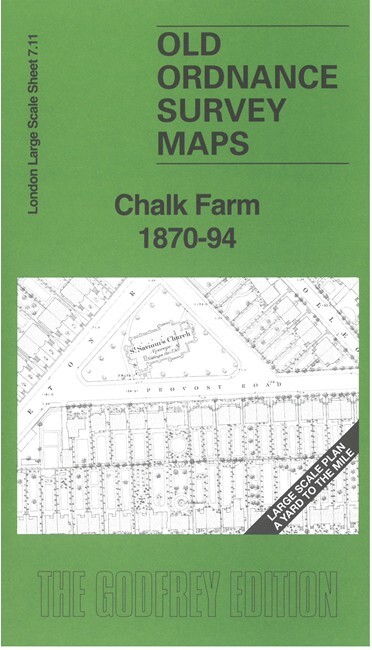
Chalk Farm 1870-94 London Large Scale Sheet 7.11 by Pamela Taylor
USD 5.05 USD
Specifications
| Type | Street Map/Directory |
| Author | Pamela Taylor |
| Publisher | Alan Godfrey Maps |
| Topic | Local History |
| Subject | History |
| Country Of Origin | United Kingdom |
| ISBN | 9781787218239 |
This very detailed map covers the Chalk Farm area and is dominated by the vast sprawl of railway lines that fan out for the LNWR Goods Depot and goods sheds, including engine sheds and fitting shop, Chalk Farm station and the 'round-house' Goods Shed. Around these the map is busy with streets of housing and the 1870 map even shows the layouts of many gardens. Other features include St Saviour's Church, Potato Market, chapels, etc. We include a reduced version of the 1894 map on the reverse.
Related Items

GEOGRAPHIA MAP OF KENT HARD COVER

Falmouth 1878 Cornwall Sheet 71.12 by Richard Oliver

Ordnance Survey Sheet 90 Penrith & Keswick

1976 Ordnance Survey Pathfinder Map ST 44/54 Wells And Wedmore (incl Meare )
MAP – Ordnance Survey 1:50 2nd Series 1980 -Malton & Pickering #100 (8715)

THETFORD, DISS & BRANDON – by Barnett’s circa 2005

LUDLOW Pathfinder 951 Ordnance Survey Map
10 Old Ordnance Survey Maps Of East Anglia – Family History