
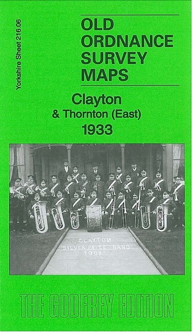
Clayton & Thornton (East) 1933 Yorkshire Sheet 216.06 by John Hargreaves
USD 5.04 USD
Specifications
| Type | Street Map/Directory |
| Author | John Hargreaves |
| Publisher | Alan Godfrey Maps |
| Topic | Local History |
| Subject | History |
| Country Of Origin | United Kingdom |
| ISBN | 9781847845917 |
This detailed map covers the centre of Clayton and the eastern part of Thornton. Features include Thornton Hall, St James church, School Green, Leventhorp Hall, tramway, Clayton Beck, Leventhorp Mills, St John's church Clayton, Town End, Oak Mills, Victoria Park etc. On the reverse we include a selection of street directory entries for 1936.
Related Items

Nuffield Road Atlas of Great Britain 1961 sixth edition- Touring Guide & Maps

Falkirk, Cumbernauld and Livingstone by Ordnance Survey (Sheet map, folded)

OS Ordnance Survey Landranger Map Sheet 186 Aldershot & Guildford – 2006
3x joblot OS Quarter-Inch Paper Maps (job OSX) 1970s

THE TIMES CONCISE ATLAS OF THE WORLD 10TH EDITION in SLEEVE RRP £75-00

1999 Local Red Book Wrexham, Caergwrlwe, chirk, Llangollen, 4th revision

1983 BEDALE & PICKHILL Ordnance Survey 1:25000 Pathfinder Map SE28/38
Rhondda Valley & Pontypridd 1904-14 One Inch Sheet 248 by Derrick Pratt