
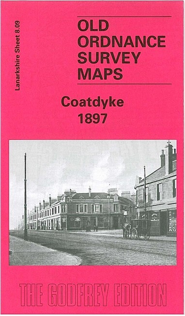
Coatdyke 1897 Lanarkshire Sheet 8.09 by Gilbert Bell
USD 5.05 USD
Specifications
| Type | Street Map/Directory |
| Author | Gilbert Bell |
| Publisher | Alan Godfrey Maps |
| Topic | Local History |
| Subject | History |
| Country Of Origin | United Kingdom |
| ISBN | 9781841511993 |
This very detailed map covers the eastern part of Coatbridge, including Coatdyke, part of Whifflet and the outskirts of Airdrie. Features include the Monkland Canal, Sheepford Locks, Rochsolloch Iron & Steel Works, Rochsolloch Farm, Greenend, Calder station, Rochsolloch Colliery, Coatdyke station, Union Tube Works, Clyde Tube Works, Crown Iron Works, Speedwell Iron Works, Whifflet Foundry, Coatbridge Tinplate Works, Coats Church, Clifton Iron Works, Phoenix Iron Works, Cliftonhill House.
Related Items

2x Vintage Ordnance Survey 2.5 Inch Maps Sheet TA 17 Reighton TA 27 Flamborough

OLD ORDNANCE SURVEY MAPS: NORTH HAMMERSMITH & BEDFORD PARK 1912
Ordnance Survey Map Of Bedford & Luton Sheet 147

OS Ordnance Survey Explorer Map 175 ‘Southend-on-Sea & Basildon’- Good condition
Swindon NW 1899 or 1922 Wiltshire Sheet 15.03
Abergavenny & The Black Mountains OS Landranger Map Sheet 161 1979

8 x OS MAPS JOB LOT Ordnance Survey (G7)

1958 Map Midland Red Bus Service Worcester Birmingham Nottingham Stafford Stoke