

Cramlington 1920 Northumberland Sheet 78.14 by Alan Godfrey
USD 5.04 USD
Specifications
| Publication Year | 2023 |
| Type | Street Map/Directory |
| Author | Alan Godfrey |
| Publisher | Alan Godfrey Maps |
| Topic | Local History |
| Subject | History |
| Country Of Origin | United Kingdom |
| ISBN | 9781787216198 |
This detailed map covers the village of Cramlington, with coverage extending southward to West Cramlington and eastward to Klondyke and Cramlington Colliery. Features include St Nicholas church, Middle Farm, Cramlington Hall, West Cramlington Colliery and village, Cramlington Colliery Railway, Cramlington Colliery (Ann and Betsy Pits), Cramlington House, South Cramlington Farm, East Cramlington Farm etc.
Related Items
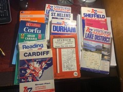
Selection of OS, Street and Tourist Maps UK and Some Overseas – About 15 In All

OS Ordnance Survey Landranger Map Sheet 117 Chester & Wrexham – 2003

North American Maps for Curious Minds: 100 New Ways to See the Continent

OS Ordnance Survey Landranger Maps: England; assorted editions 1993-2013 – ‘vgc’

OL22 New Forest OS Explorer Map Ordnance Survey

Ilfracombe & Minehead 1897 One Inch Sheet 277 by Mike Bone

MAP OF Birmingham (East) 1913 Warwickshire Sheet 14.06 NEW 9781787213784

Azores Tour & Trail Super-Durable Map (2nd edition) by Jan Kostura